Maps of Afghanistan and the Middle East
In
the MSU Map Library
|
Year |
Publisher |
LC Call Number |
AGS/Other Call Number |
|
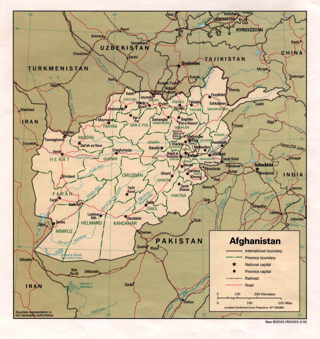
Afghanistan |
1993 |
Central
Intelligence Agency |
G7630
1993 .U657 Map |
White
binder at staff reference |
|
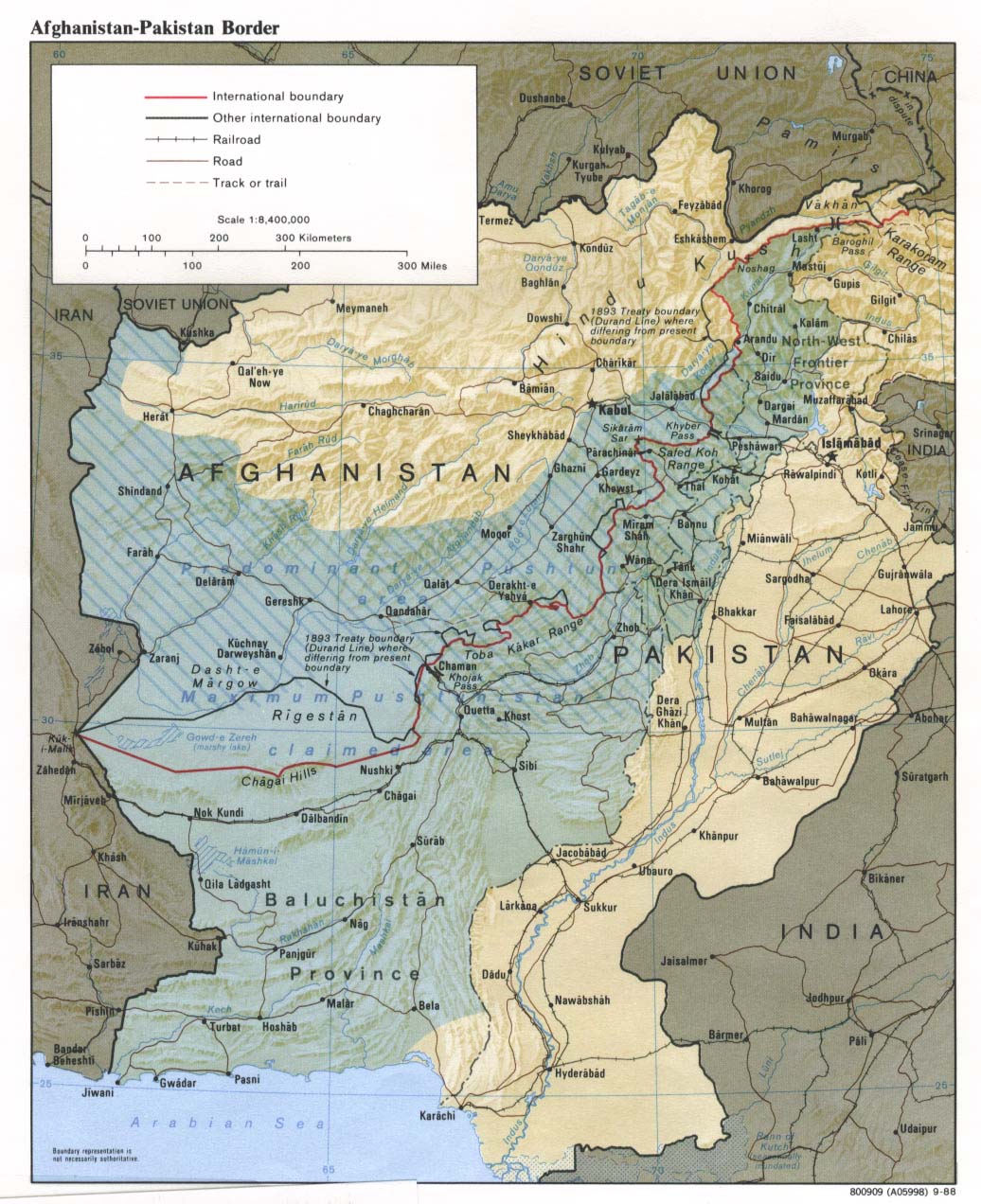
Afghanistan--Pakistan
border. |
|
Central
Intelligence Agency |
G7631.F2 1988 U5 Map |
White binder at staff reference [Scanned
imagefrom U of Texas] |
|
Caspian Region : Promise and Peril ; The Caspian
from Orbit |
1999 |
National Geographic Society |
G5692.C3 A47 1999 N3 Map |
Supplementary Maps Cabinet, G 1 .N27 vol. 195 no.
5 |
|
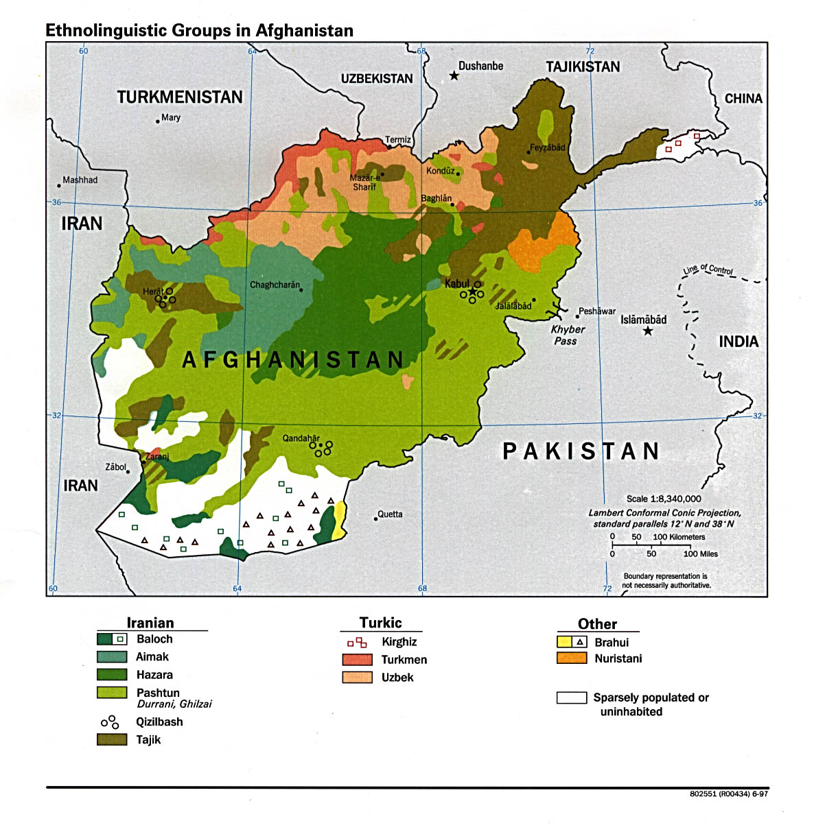
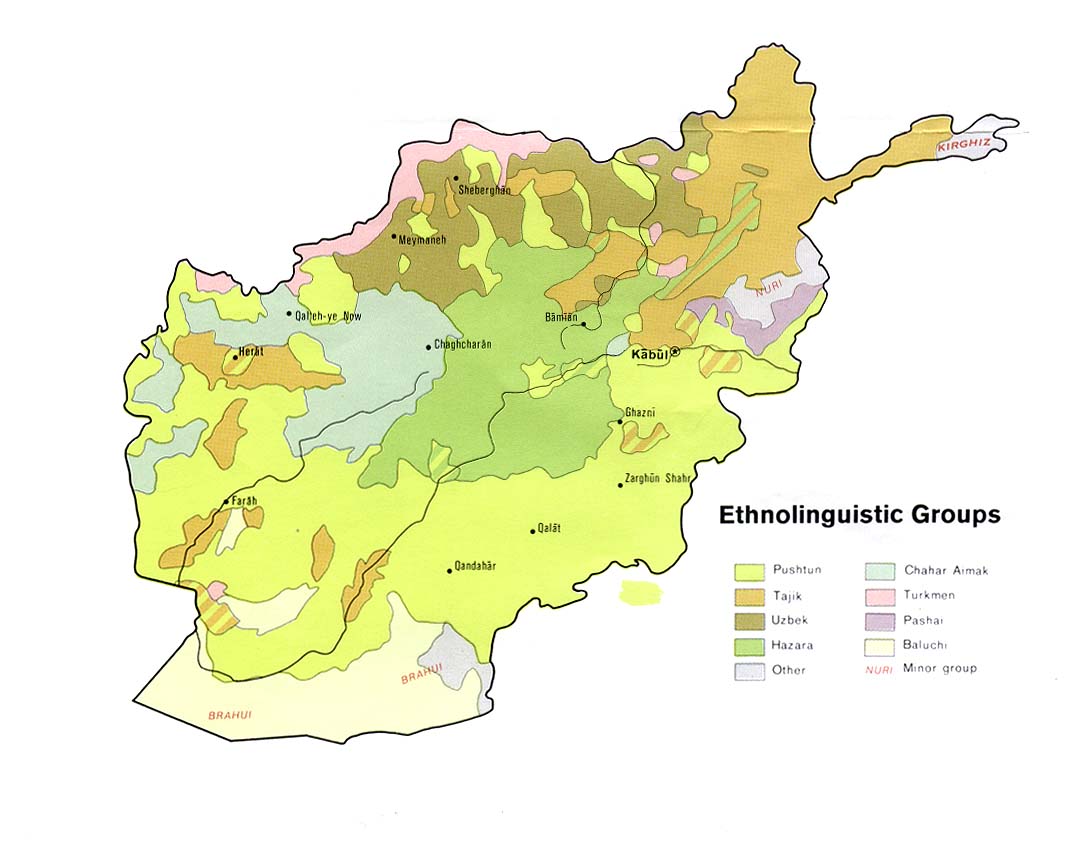
Ethnolinguistic
groups in Afghanistan. |
1997
and 1992 |
Central
Intelligence Agency |
G7631.E3
1997 U5 Map |
|
|
Geologic Map of Afghanistan (map 1 of 4 accompanying
« Geology and Mineral Resources of Afghanistan » (note : this is a color map) |
1995 |
United Nations Economic and Social Commission for
Asia and the Pacific |
TN 99 .A85 v. 11 no.1 |
Supplementary Maps upright filing cabinet |
|
|
1980 |
Central
Intelligence Agency |
|
White binder at staff reference [Scanned imagefrom
U of Texas] |
|
Magmatic Formations of Afghanistan (map 1 of 4
accompanying « Geology and Mineral Resources of Afghanistan » |
1995 |
United Nations Economic and Social Commission for
Asia and the Pacific |
TN 99 .A85 v. 11 no.1 |
Supplementary Maps upright filing cabinet, at LC
call number |
|
Major
insurgent groups in Afghanistan |
1985 |
Central
Intelligence Agency |
|
White binder at staff reference |
|
Mineral Resources Map of Afghanistan (map 2 of
4 accompanying « Geology and Mineral Resources of Afghanistan » |
1995 |
United Nations Economic and Social Commission for
Asia and the Pacific |
TN 99 .A85 v. 11 no.2 |
Supplementary Maps upright filing cabinet, at LC
call number |
|
South Asia (note : Egypt-Himalaya) |
1964 |
Verlag |
|
400.3 A 1964 |
|
South Asia (note : physical relief, Afghanistan-India; large
sheet) |
1993 |
Central Intelligence Agency |
|
400.3 A 1993 |
|
South Asia (note : political reference, Afghanistan-India
; large sheet) Also,
small sheet from 1987 in white binder |
1998 also 1985 |
Central Intelligence Agency |
|
400.3 B 1998 |
|
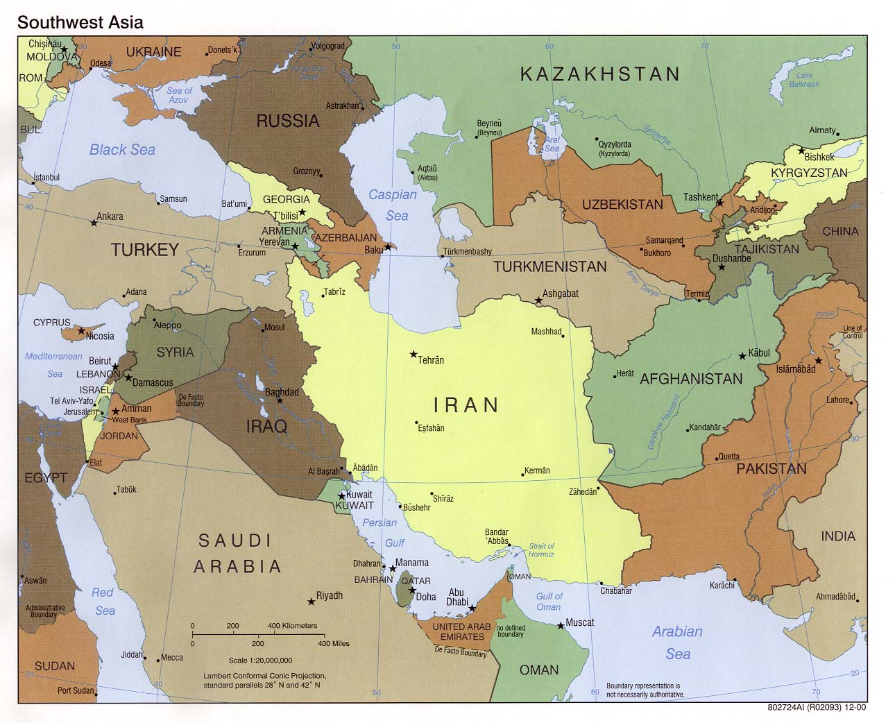
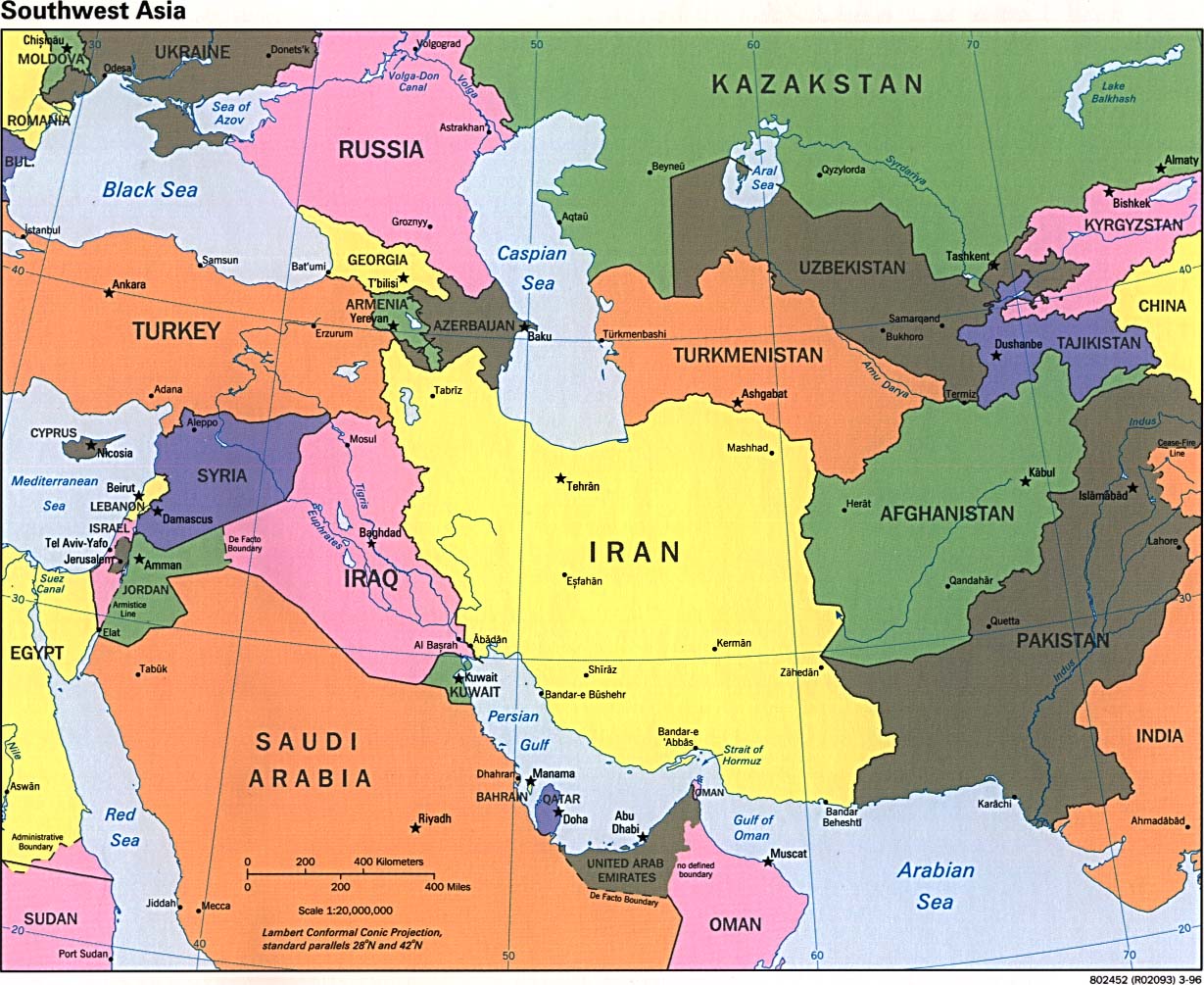
Southwest Asia |
2000, 1996 |
Central Intelligence Agency |
G 7420 1996 .U5 Map G 7420 2000 .U54 Map |
White binder at staff reference, see both « Asia
» and « Middle East » [Scanned image [2000,
1996]from
U of Texas] |
|
Southwest Asia |
1963 |
National Geographic |
|
400.3 B 1963 |
|
Tectonic Map of Afghanistan (map 3 of 4 accompanying
« Geology and Mineral Resources of Afghanistan » |
1995 |
United Nations Economic and Social Commission for
Asia and the Pacific |
TN 99 .A85 v. 11 no.3 |
Supplementary Maps upright filing cabinet |
Map Sets
|
|
Scale |
Year |
LC Call Number |
AGS/Other Call Number |
|
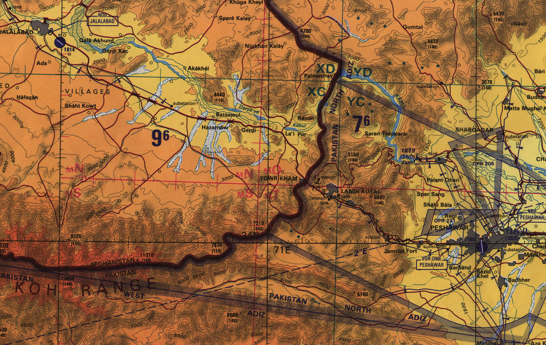
Tactical
Pilotage Charts (TPC); Sheets G6a, G6c, G6d, H7b, H8a |
1:500,000 |
1991-1992 |
none |
Aeronautical
Charts Drawers |
|
Operational
Navigation Charts (ONC); Sheets G6, H7, H8 |
1:1,000,000 |
|
none |
Aeronautical
Charts Drawers |
|
Jet
Navigation Charts (JNC); Sheets 23 & 36 |
1:2,000,000 |
|
|
Aeronautical
Charts Drawers |
|
Afghanistan
(Survey of India, British Government) |
1:253,440
(1” = 4 miles) |
1942 |
None |
424-b
A-1:253,440 |
|
|
Description |
Publisher/Date |
LC Call number |
|
Geology
and mineral resources of Afghanistan / ( v. 11 of Atlas of Mineral
Resources of the ESCAP Region) |
|
United
Nations Economic and Social Commission for Asia and the Pacific, 1995 |
Atlas
shelves TN99 .A85 v.11 |
|
General
atlas of Afghanistan = Atlas general de l' Afghanistan. |
|
Sahab
Geographic & Drafting Institute, [1974] |
Supersize
Atlas G2265
.M8 1973 |
|
Atlas
of the Middle East |
1
atlas (76 p.) : col. ill., col. maps (56 p.) ; 42 x 31 cm. |
Central
Intelligence Agency |
Supersize
Atlas G2205
.U48 1993 Staff
Reference G2205
.U48 1993 |
|
Title |
Description |
Publisher/Date |
LC Call Number |
|
Historical
and political gazetteer of Afghanistan. Edited by Ludwig W. Adamec. |
6
volumes |
Druck-
u. Verlagsanst, 1972- |
Quick
Reference DS351
.A3 |
|
Gazetteer
of Afghanistan : names approved by the United States Board on Geographic
Names, 2nd ed. / prepared by: Lawrence K. Marsh and Gerd
Quinting. |
xxvi,
326 p. : map ; 28 cm. |
Defense
Mapping Agency, [1983] |
|
|
Afghanistan:
official standard names approved by the United States Board on Geographic
Names. |
|
1971 |
Quick
Reference DS351 .U55 |
Other scanned images from the University of Texas, Perry-Castañeda Library
Other scanned images linked from Odden's Bookmarks (Browse - Maps, New - Afghanistan)
Oct. 11, 2001